WOC 567
Page 567

Geography
As global citizens, each of us must stay on top of changes in the world. Just as we try to understand key facts about each of the 50 states, we must also try to understand important information about regions and countries in the world. The section that follows will give you the map skills you need to begin your work.
Using Maps
Finding Direction
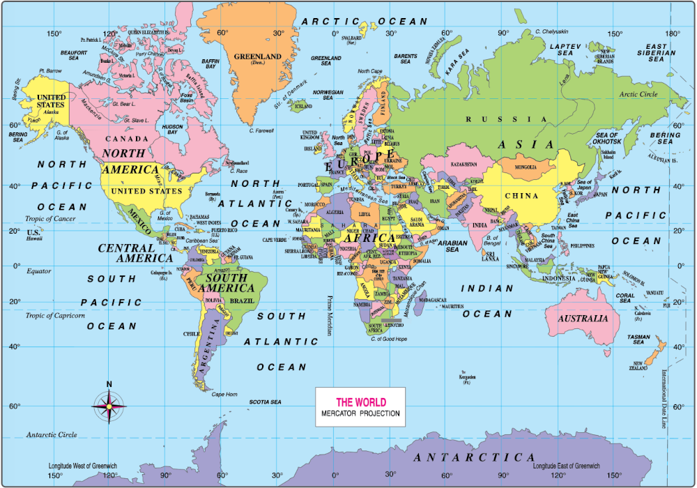
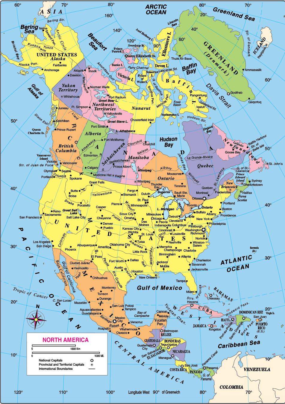
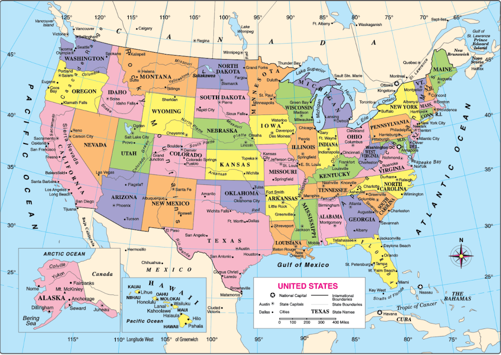
Mapmakers use special marks and symbols to show where things are and to give other useful information. Among other things, these marks and symbols show direction (north, south, east, and west). On most maps, north is at the top. But you should always check the compass rose, or directional finder, to make sure you know where north is. If there is no symbol, you can assume that north is at the top.
Finding Information
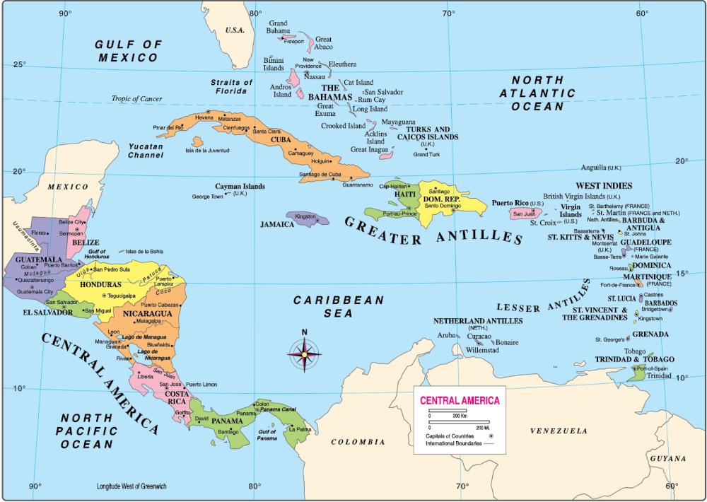
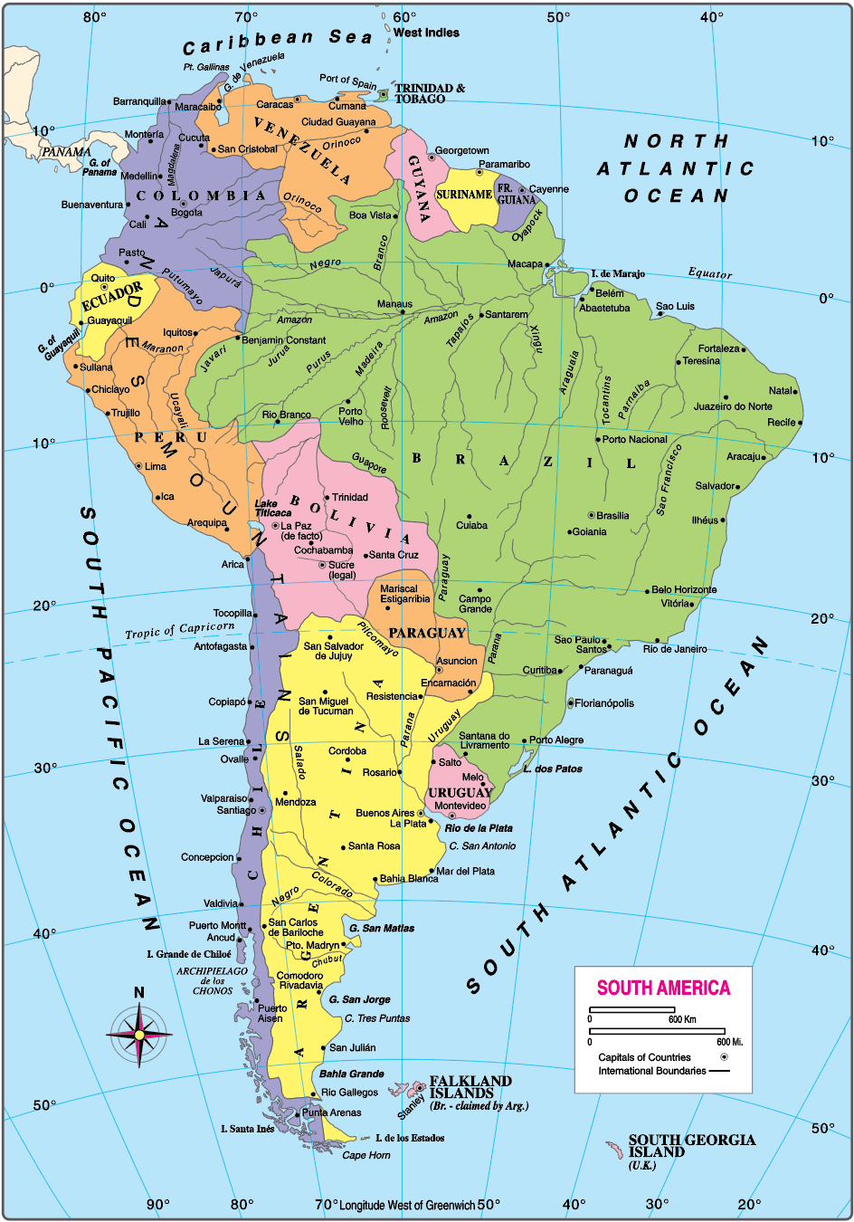
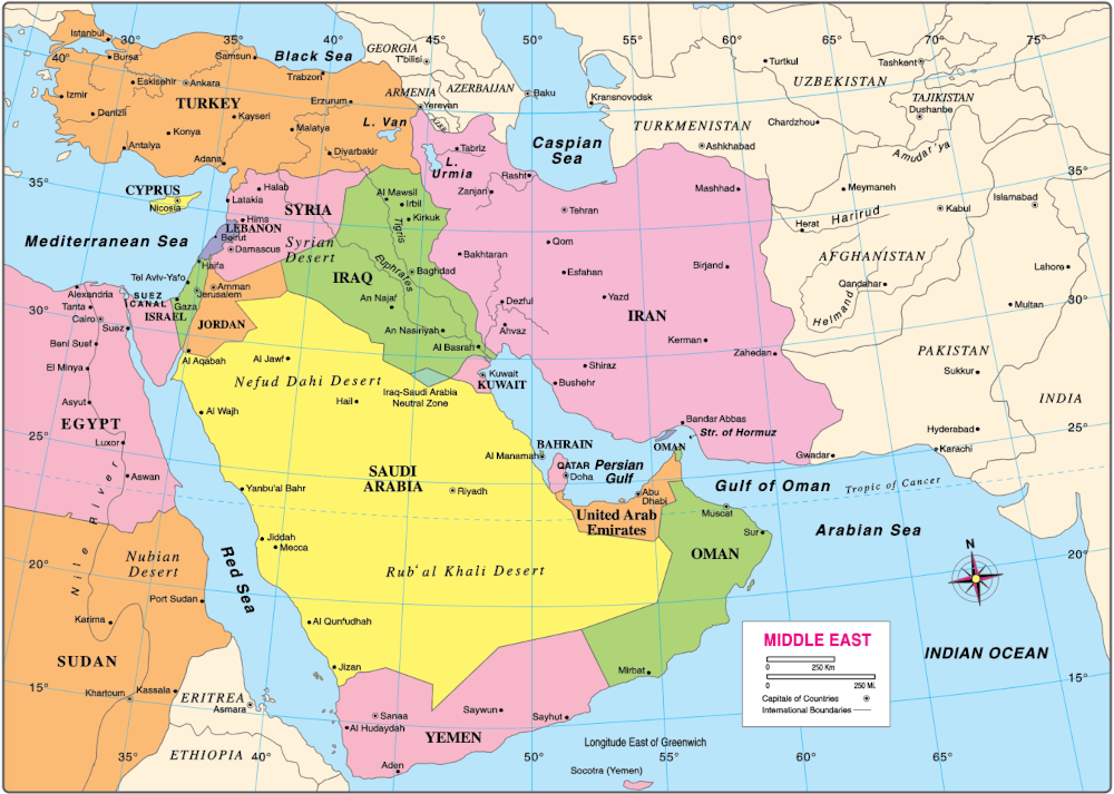
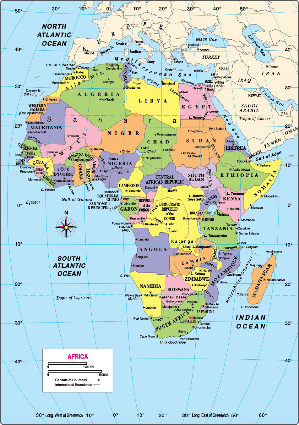
Other important marks and symbols are explained in a box printed on each map. This box is called the legend, or key. It is included to make it easier for you to understand and use the map. Below is the United States map legend. (See page 571.) This legend includes state boundaries.

WOC 568

Page 568
Measuring Distances
To measure distances on a map, use the map scale. (See the sample above.) Line up an index card or a piece of paper under the map scale and put a dot on your paper at “0.” Put other dots at 100, 200, 300, and so on. You can now measure the approximate distance between points on the map.
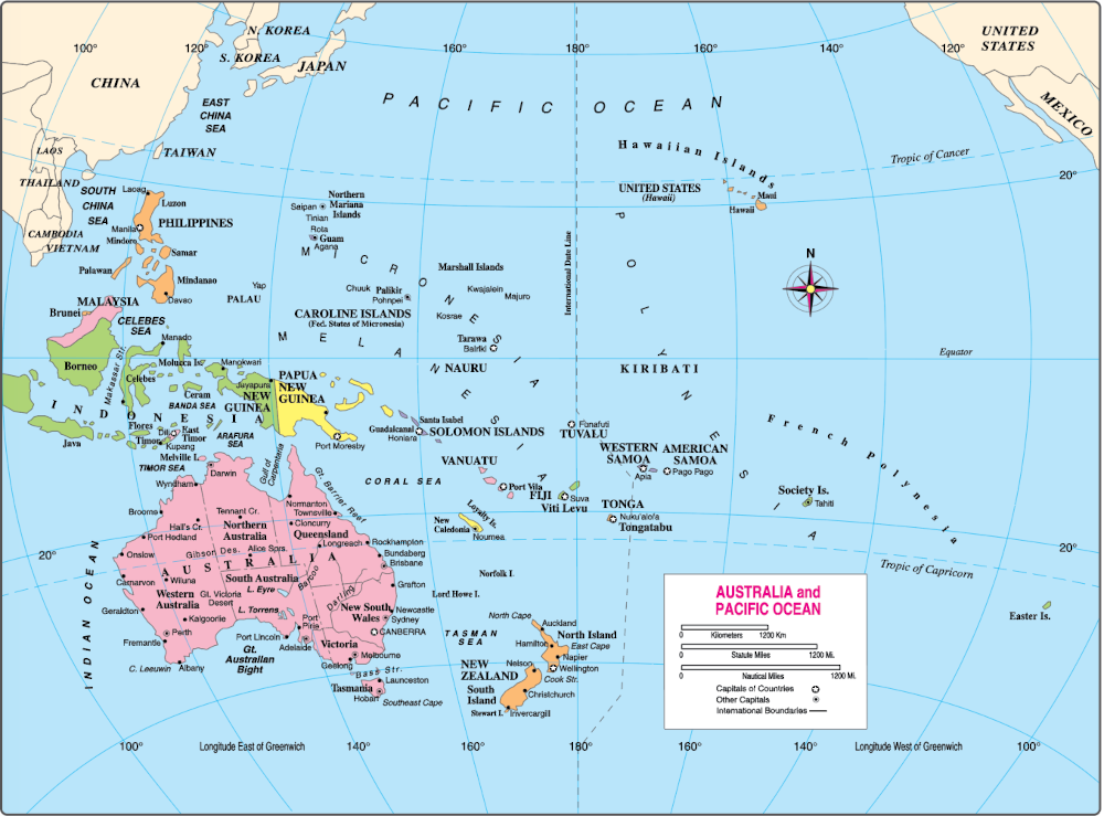
Locating Countries
Latitude and longitude lines are another helpful feature of most maps. Latitude and longitude refer to imaginary lines that mapmakers use. Together, these lines can be used to locate any point on the earth.
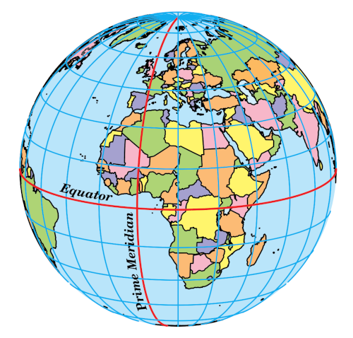
Latitude
The lines on a map that go from east to west around the earth are called lines of latitude. Latitude is measured in degrees, with the equator being 0 degrees (0°). Above the equator, the lines are called north latitude and measure from 0° to 90° north (the North Pole). Below the equator, the lines are called south latitude and measure from 0° to 90° south (the South Pole). On a map, latitude numbers are printed along the sides.
Longitude
The lines on a map that run from the North Pole to the South Pole are lines of longitude. Longitude is also measured in degrees. The prime meridian, which runs through Greenwich, England, is 0° longitude. Lines east of the prime meridian are called east longitude; lines west of the prime meridian are called west longitude. On a map, longitude numbers are printed at the top and bottom.
Coordinates
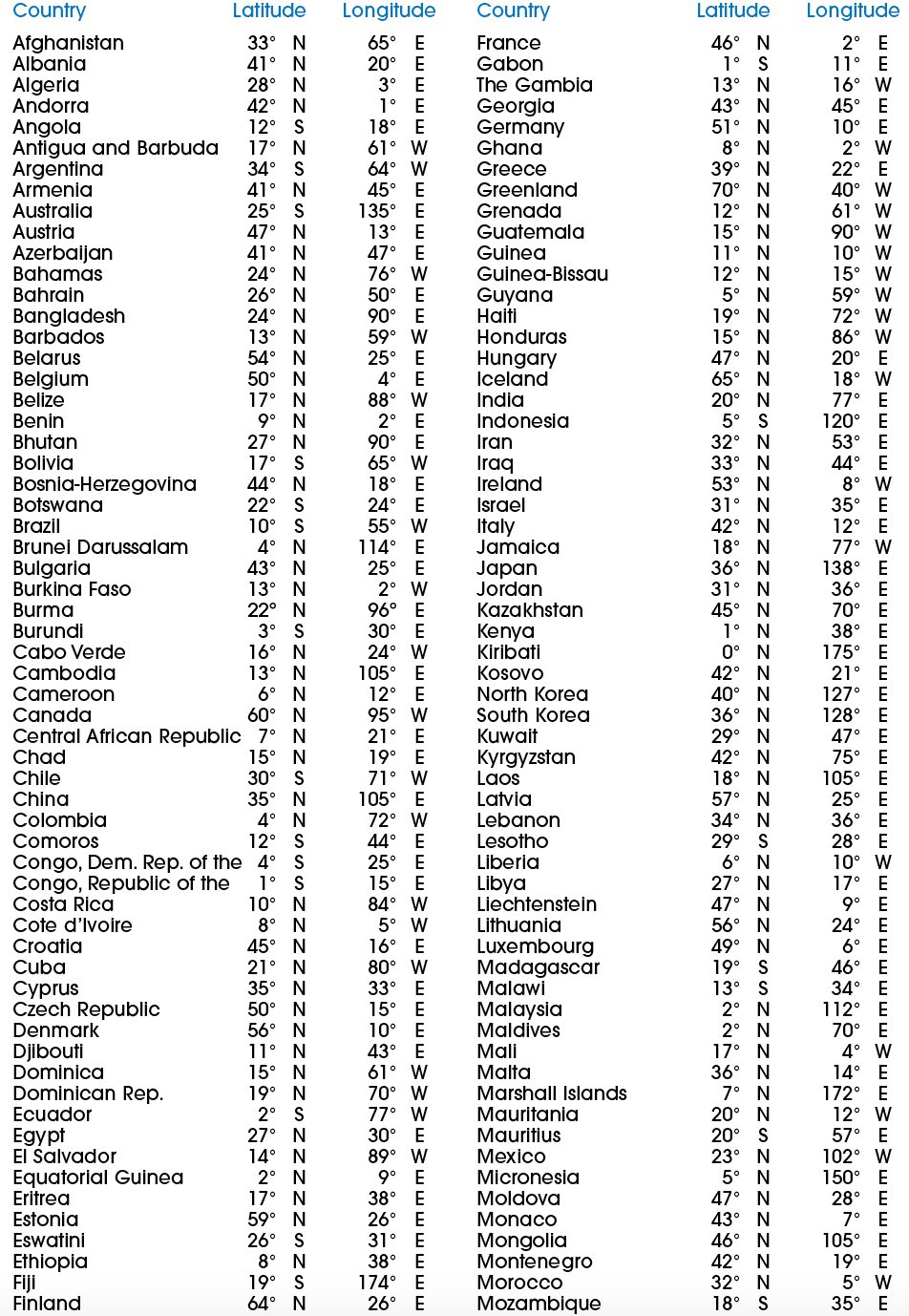
The latitude and longitude numbers of a country or other place are called its coordinates. In each set of coordinates, latitude is given first, then longitude. To locate a certain place on a map using its coordinates, find the point where the two lines cross. (You will find an extensive list of coordinates for countries of the world on pages 579–580.)
WOC 569
Page 569
WOC 570
Page 570
WOC 571
Page 571
WOC 572
Page 572
WOC 573
Page 573
WOC 574
Page 574
WOC 575
Page 575
WOC 576
Page 576

WOC 577
Page 577

WOC 578
Page 578
WOC 579
Page 579
Index to World Maps
WOC 580
Page 580
