Bookmark

Sign up or login to use the bookmarking feature.

65 Geography

Page
575
from

Geography Section Opener

Start-Up Activity

Ask your students, "Where are you?" They will probably look puzzled and may haltingly offer answers: "Right here," "In English class," "In the high school." Press them to become more precise. They might indicate which desk in which row in what room of what high school in what city in what state in what country they live. Keep pressing them until they reach a global perspective.

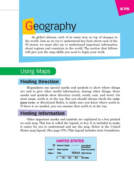
Then tell students to open to page 575 in their handbooks. On it and the pages that follow, they will gain a broader perspective of their world. Teach them about finding direction and information on maps, and continue your instruction on page 576. Then let them know that you will ask them to closely study each map on the following pages and will prompt them to think more deeply about their world. (Whatever time you spend on these activities will reap dividends in student learning in all classes. It will help them become citizens not just of your town, state, or nation, but also of the world at large.)

Think About It

“Wars of nations are fought to change maps. But wars of poverty are fought to map change.”

—Muhammad Ali

Page 576 from Write Ahead

Using Maps (Cont.)

Continue leading students through the instructions for understanding maps. Help them measure distances and locate countries using latitude, longitude, and coordinates. Make sure students know that they can look up the coordinates of countries on pages 587–588.

LAFS Standard:
NE ELA Standard:

Related Resource Tags

Click to view a list of tags that tie into other resources on our site

Page 577 from Write Ahead

The World

Direct students to this page. They've seen the world map many times before, but it bears reflection and contemplation. This world is the only home human beings have ever known (aside from occasional apartments on the moon). The map is not just a record of the way things are, but of how things have developed over time. Get students to engage with the map by asking them questions about it:

  • Find where you live.
  • Find where you would like to live. Why?
  • Find the farthest point you have ever traveled from home. Why did you go there?
  • Find the most mysterious place on the planet. Why does it intrigue you?

Point out to students that this map is a Mercator projection, which displays data accurately at the equator but less accurately the closer one gets to the poles. (The problem is displaying a globe on a flat surface.) Show students other map projections and ask how they change their perspective of Earth.

LAFS Standard:
NE ELA Standard:

Related Resource Tags

Click to view a list of tags that tie into other resources on our site

Page 578 from Write Ahead

North America

As students study the North American map, point out that it is not a Mercator projection like the map on page 577. The lines of longitude converge on the North Pole, showing a more accurate size for Canada, Greenland, and Alaska. Ask questions to get students thinking about the map:

  • Where is the North Pole? (At the top of the map) Would the Jolly Old Elf's workshop be on land or on an iceberg? (It would have to be on ice.) As maximum sea ice shrinks, how will the countries bordering the Arctic Ocean respond? (They are already scrambling to claim ocean territory, set up shipping lanes, and drill for oil.)
  • Why would Teddy Roosevelt want to build a canal in Panama? (It's the narrowest isthmus between the Caribbean Sea and the Pacific Ocean, a perfect trade route.)
  • Why is the Mississippi River so big? (It drains the central section of the United States, from Western Pennsylvania to Western Montana.)
  • Why are the Great Lakes and the St. Lawrence Seaway so important to the United States and Canada? (They provide a huge amount of fresh water and shipping lanes into the center of both nations.)
  • Where do "the tropics" begin? (The Tropic of Cancer passes through central Mexico and encompasses Cuba, Haiti, the Dominican Republic, Puerto Rico, and all points south on this map.)
  • If you could travel to any place in North America, where would you go? Why?
LAFS Standard:
NE ELA Standard:

Related Resource Tags

Click to view a list of tags that tie into other resources on our site

Page 579 from Write Ahead

United States

From elementary school, U.S. students have studied this map. Lead them on a scavenger hunt through it:

  • Find your state and the city closest to you.
  • Find the farthest point away where a relative or friend lives.
  • Find a spot you would like to visit sometime. Why?
  • Find a state where you would like to cross the border into another country. What country would you visit? Why?
  • What state do you think is the coolest? Why?
  • What state do you think is the weirdest? Why?
LAFS Standard:
NE ELA Standard:

Related Resource Tags

Click to view a list of tags that tie into other resources on our site

Page 580 from Write Ahead

Central America and the Caribbean

Use questions to help students reflect on the map on this page:

  • What do you notice about the nations on this map? (All are either islands or on an isthmus surrounded by water. All are also quite small, the size of states in the U.S.)
  • How does the geography of these nations affect them? (They must make great use of the seas that surround them; they also are somewhat isolated from other countries; their size means they need to fight for their position among much larger countries.)
  • Historically and politically, how have these nations fared: Nicaragua, Panama, Cuba, Haiti? (All have had much turmoil, some of it caused by dictatorships, some of it caused by exploitation from the US and other major powers.)
  • Why would there be "Pirates of the Caribbean"? (The wide-open seas and many islands made the place a hotbed for trade; the small nations meant that pirates could easily escape regional authorities; the Triangle Trade of cash crops/slaves/manufactured goods attracted many unsavory people to the Caribbean.)
  • If you could travel to any place in Central America or the Caribbean, where would you go. Why?
LAFS Standard:
NE ELA Standard:

Related Resource Tags

Click to view a list of tags that tie into other resources on our site

Page 581 from Write Ahead

South America

Have students analyze the map on this page, noting the nations and oceans. Then inspire reflection with questions:

  • What do you notice about Brazil? (Students may note its huge size, stretching from the equator in the north to well past the Tropic of Capricorn in the south and extending from Peru in the west to the central Atlantic in the east. They also might note that Brazil s dominated by rivers, specifically the Amazon, one of the greatest rivers on Earth. The map does not show [but students should know] that about half of Brazil is the Amazon Rainforest, considered the "lungs of Earth" because of how much carbon dioxide it absorbs and how much oxygen it produces.)
  • What do you notice about Argentina? (It extends from the Tropic of Capricorn in the north to Cape Horn in the south. Its climate goes from intense heat and humidity to cold oceans with penguins.)
  • What do you notice about Chile? (It is very long and thin, running half the length of South America along the Pacific Ocean. The map doesn't make this clear, but Chile is actually a very mountainous nation, following the Andes, which are formed by the collision of the Pacific and South American plates. One of the driest, highest, and coolest places on the planet is the Atacama Desert in Chile, a barren Mars-like landscape that is treasured by astronomers because of the clear viewing from the Atacama Large Millimeter Array of telescopes.)
  • What do you notice about Columbia, Venezuela, Guyana, Suriname, and French Guiana? (All are smaller nations in the tropics. Each has had a turbulent past, again because of local dictators, drug lords, and the exploitative practices of larger nations.)
  • If you could travel to any place in South America, where would you go, and why?
LAFS Standard:
NE ELA Standard:

Related Resource Tags

Click to view a list of tags that tie into other resources on our site

Page 582 from Write Ahead

Middle East

Have students closely analyze this map. Use questions to guide their thinking:

  • What do Egypt and Sudan have in common? (Both are nations in northeast Africa, and both share the great Nile River. Both are tropical, origins of human civilization and migration.)
  • What do Israel, Jordan, Lebanon, and Syria share in common? (All are small nations on the land bridge between Asia, Africa, and Europe, on or near the Mediterranean Sea.)
  • What do Saudi Arabia, Iraq, Iran, and Turkey have in common? (All are large nations with access to water, whether the Red Sea, the Persian Gulf, the Caspian Sea, the Black Sea, or the Mediterranean Sea.)
  • Why would the Middle East be a natural spot for the "cradle of civilization"? (The Nile, Tigris, and Euphrates create fertile lands for agriculture and settled city-states; the position at the land bridge between three continents makes this place critical for trade and military control.)
  • How would you characterize current governments in the countries on this map? (Egypt, Saudi Arabia, and Iran currently are stable but led by totalitarian governments. Israel and Turkey are currently stable democracies but are moving toward more authoritarian forms of government. Iraq, Lebanon, and Jordan are troubled democracies. Syria and Yemen are in civil war.)
  • How has the geography of this region set it up for thousands of years of conflict? (As the cradle of civilization, the birthplace of three monotheistic Abrahamic religions, and the center for millennia of trade, this region has been hotly contested for many centuries.)
  • If you could travel to any place in the Middle East, where would you go? Why?
LAFS Standard:
NE ELA Standard:

Related Resource Tags

Click to view a list of tags that tie into other resources on our site

Page 583 from Write Ahead

Africa

Have students carefully study the map of Africa. Prompt them with questions:

  • What do you notice about this continent? (Students may notice that it is huge, much bigger than Europe and the Middle East; it is surrounded by water, with the Mediterranean Sea on the north, the Atlantic Ocean on the west, the Indian Ocean on the east, and the Red Sea on the north east it contains many nations; it extends north of the Tropic of Cancer and south of the Tropic of Capricorn; the nations in the Sahara Desert are large, as are the nations in south and central Africa, but the sub-Saharan nations are smaller; Africa borders Europe and the Middle East.)
  • Human beings began in East Africa (Tanzania, Kenya, Ethiopia, South Sudan, Sudan, and Egypt) and spread from there throughout the world. Why might these areas provide a good home for humans? (The major lakes and rivers could support settlements; the north and south ends of the Red Sea allowed crossing into Asia and then into Europe.)
  • North Africa has been invaded by Greeks, Romans, Arabs, Turks, French, Germans, and the Allies. Why has this area been so hotly contested? (It borders on the Mediterranean Sea and is temperate and fertile, unlike the Saharan lands south of it.)
  • Western Africa was shaped by the Triangle Trade (slaves from Africa for cash crops from the New World for manufactured goods from the Old World). Other areas (such as the Congo and South Africa) were shaped by European imperialism. How have these outside influences changed Africa? (They have forced native populations to adopt a European style of government and economy; they have artificially drawn state borders, grouping adversaries in the same nation and splitting other homogenous groups across national boundaries; they have imposed European languages upon the systems of governance and education.)
  • Why would Madagascar contain creatures (including "Hobbit" humans) not found anywhere else on the globe? (It is a large island isolated off the African Coast in the Indian Ocean.)
  • If you could travel to any place in Africa, where would you go? Why?
LAFS Standard:
NE ELA Standard:

Related Resource Tags

Click to view a list of tags that tie into other resources on our site

Page 584 from Write Ahead

Europe

Have students study this map closely. Inspire their thinking with questions:

  • What do you notice about Europe? (It has many smaller nations packed into a continent bordered by water on three sides; each nation is ancient, and most have their own languages; the nations in the west and north are larger, those in the center are small and broken up, and Russia in the east is huge.)
  • Which nations on this map had empires? (Greece, Italy [Rome], Spain, Portugal, France, Belgium, Germany, the United Kingdom, Russia, and others)
  • The empires of Greece and Rome were ancient, but the other European empires coincided with the discovery of the New World. Why did this discovery make European countries establish empires? (They bordered the Atlantic Ocean and could easily send ships to claim territory and set up colonies; those that did not get a piece of the New World grabbed pieces of the Old World in Africa, the Middle East, India, and the Far East.)
  • The small countries in southeastern Europe have many different ethic groups, have been fought over continuously for two thousand years, and were behind the Iron Curtain for much of the second half of the 20th Century. How do these facts explain their geography? (The different ethnic groups do not easily band together, were forced to do so under Soviet domination, and then split apart after the fall of the Soviet Union.)
  • If you could travel to any place in Europe, where would you go? Why?
LAFS Standard:
NE ELA Standard:

Related Resource Tags

Click to view a list of tags that tie into other resources on our site

Page 585 from Write Ahead

Asia

Have students study the map of Asia. Use the following questions to guide their thinking:

  • What do you notice about Asia? (Students may note it is huge; it has part of Russia and all of China and India in it; it has many small nations in the Middle East and in the South Pacific.)
  • Asia holds more than half of the world's population (4.5 billion people, with 1.4 billion in China and nearly that many in India). Why are these areas so populous? (India and China both have been cradles of civilization, with thousands of years of occupation; both are fertile areas with excellent river systems to facilitate civilization; both are traditionally rural societies [which favor many children]; both have worked hard to industrialize and digitize their economies; both have religions [Hinduism and Buddhism] that have valued large families.)
  • Russia extends from Europe in the west to Alaska in the east. Why is it less populous than the much-smaller China and India? (Russia is generally cold, with much of its territory north of the Arctic Circle; the lower latitudes are landlocked and subject to the extremes of summer and winter as well as desert conditions.)
  • What do you notice about the South Pacific? (Many small island nations extend between Asia and Australia.)
  • In 2004, a 9.2 magnitude earthquake struck the northwestern tip of Sumatra and unleashed a tsunami that swept across the Indian Ocean and killed more than 260,000 people in 14 countries on the continents of Asia and Africa. What can you infer about this event from the map? (Sumatra must lie on a major fault line between the Pacific and Indian Ocean plates; tsunamis can travel thousands of miles across open ocean; many people live along the coasts of the Indian Ocean; the power of the Earth dwarfs the power of people living on it.)
  • If you could travel to any place in Asia, where would you go? Why?
LAFS Standard:
NE ELA Standard:

Related Resource Tags

Click to view a list of tags that tie into other resources on our site

Page 586 from Write Ahead

Australia and Pacific Ocean

Have students study the map on this page. Prompt their thinking with the following questions:

  • What do you notice about this map? (Students will note a lot of water, a big Australia, and small islands spreading out through the Pacific Ocean.)
  • What do you notice about Australia? (Students might note that it is big [about the size of the continental US]; the famous cities of Melbourne and Sydney are in the east; the nation straddles the Tropic of Capricorn; Tasmania lies off the southern coast, and New Zealand lies to the east.)
  • Why is New Guinea two different colors? (Two different nations occupy the island; Britain had conquered the whole island and then gave part to Australia; in 1975, Papua New Guinea gained independence.)
  • Ancient Polynesian seafarers riding on outrigger sail boats colonize the many islands of the Pacific, including Hawaii, and even landed in South America. Check the scale of miles. What does it tell you about ancient Polynesian seafarers? (They were master sailors with incredible skills and determination.)
  • Many of the islands played a key role in World War II—Hawaii, Guadalcanal, the Marshall Islands, Guam, the Philippines, and many others. Why? (The war in the Pacific pitted the US against Japan, and both needed to control the islands in order to control the ocean.)
  • If you could travel anywhere in Australia or the Pacific Ocean, where would you go? Why?
LAFS Standard:
NE ELA Standard:

Related Resource Tags

Click to view a list of tags that tie into other resources on our site

Page 587 from Write Ahead

Index to World Maps

Teach your students how to use this index.

  • Latitude lines run east and west, with the equator at 0°. Lines above the equator are marked in degrees north, and lines below it are marked in degrees south.
  • Longitude lines run north and south, with the line through Greenwich, England, at 0°. Lines to the left are marked in degrees west, and lines to the right are marked in degrees east.

To find a nation, students can look for the convergence of longitude and latitude lines on whatever map shows that convergence.

LAFS Standard:
NE ELA Standard:

Related Resource Tags

Click to view a list of tags that tie into other resources on our site

Page 588 from Write Ahead

Index to World Maps (Cont.)

In addition to supporting students as they use the index, also direct them to the "Topographic Tally Table" at the end. It contains interesting facts about continents, rivers, islands, and oceans.

LAFS Standard:
NE ELA Standard:

Related Resource Tags

Click to view a list of tags that tie into other resources on our site