WT 400
Page 400
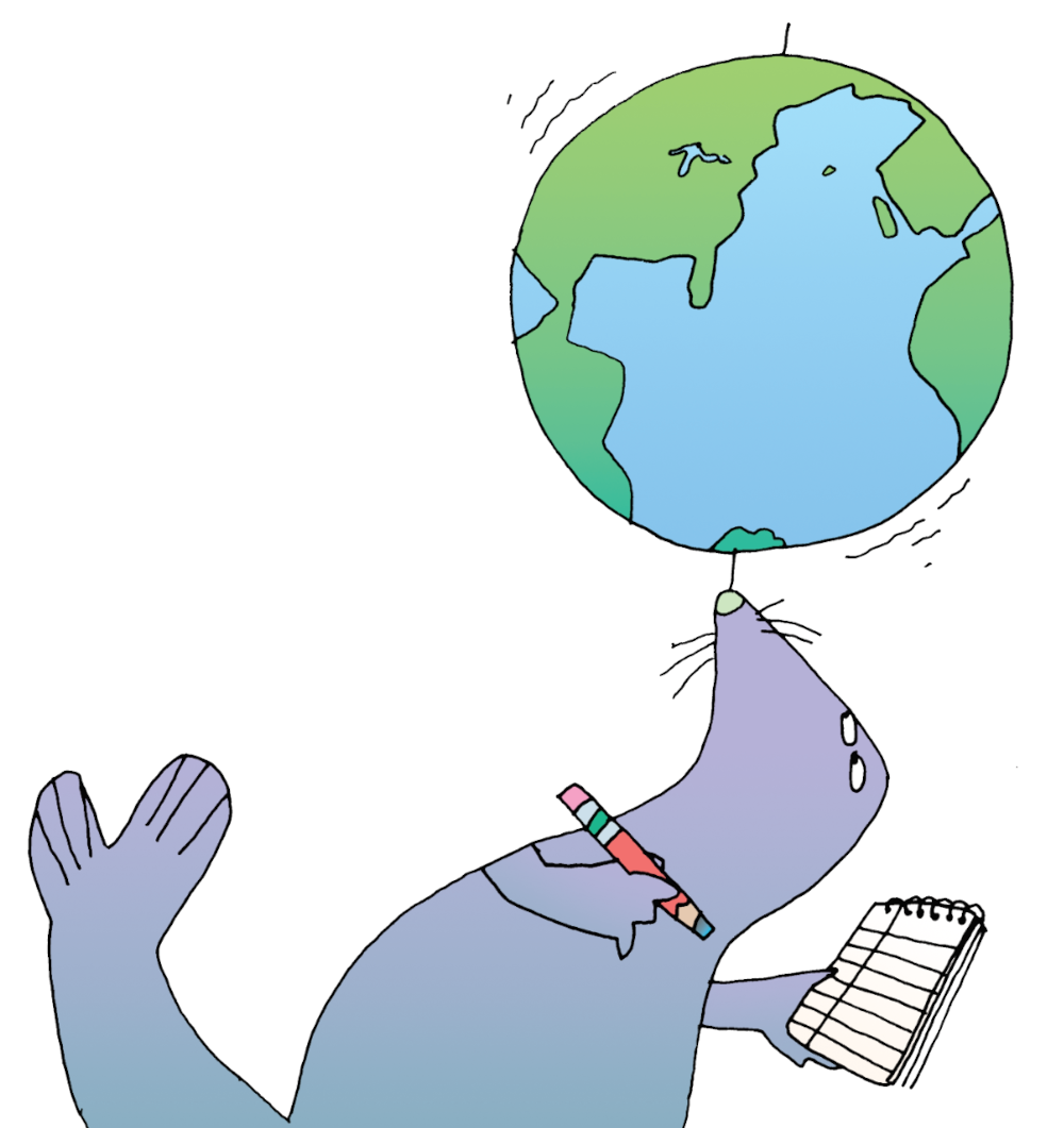
Surveying Social Studies
Social studies is the study of people, places, and events around our world. This part of the almanac includes neat facts about the United States, including a full list of presidents and holidays. But to begin your studies, you’ll explore the geography of the world.
Mapping Our World
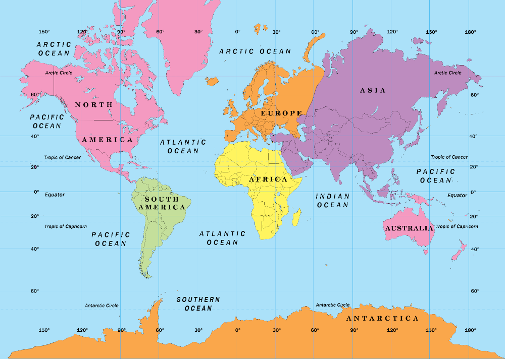
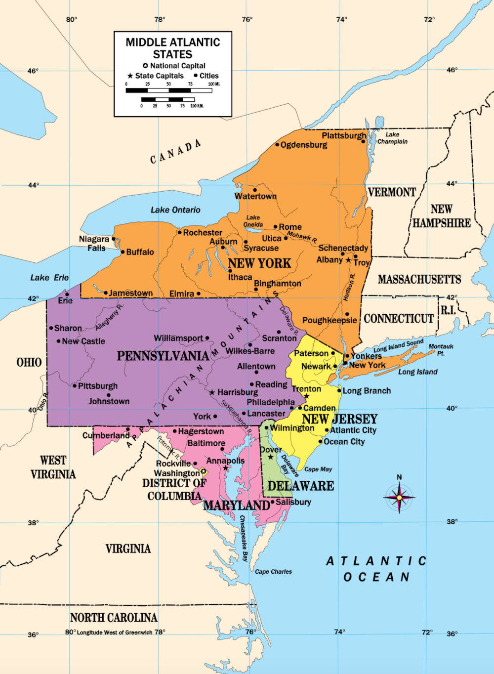
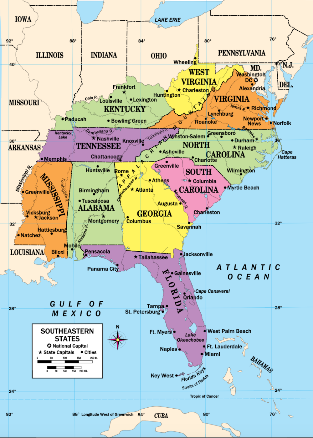
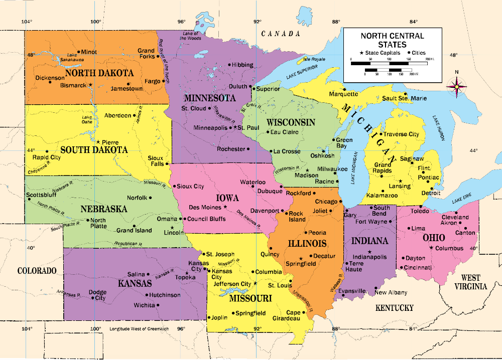
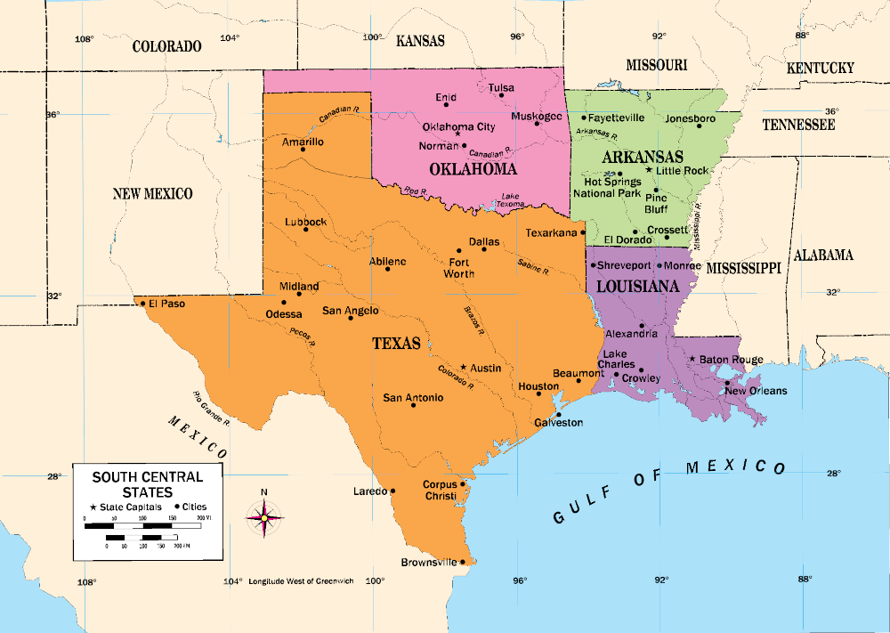
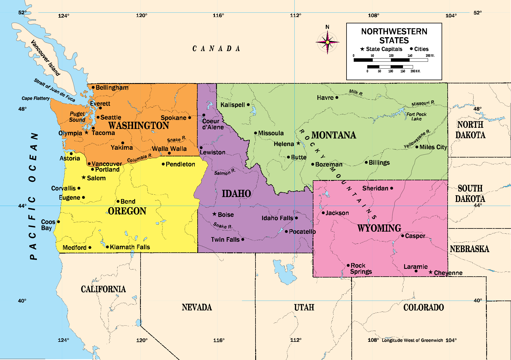
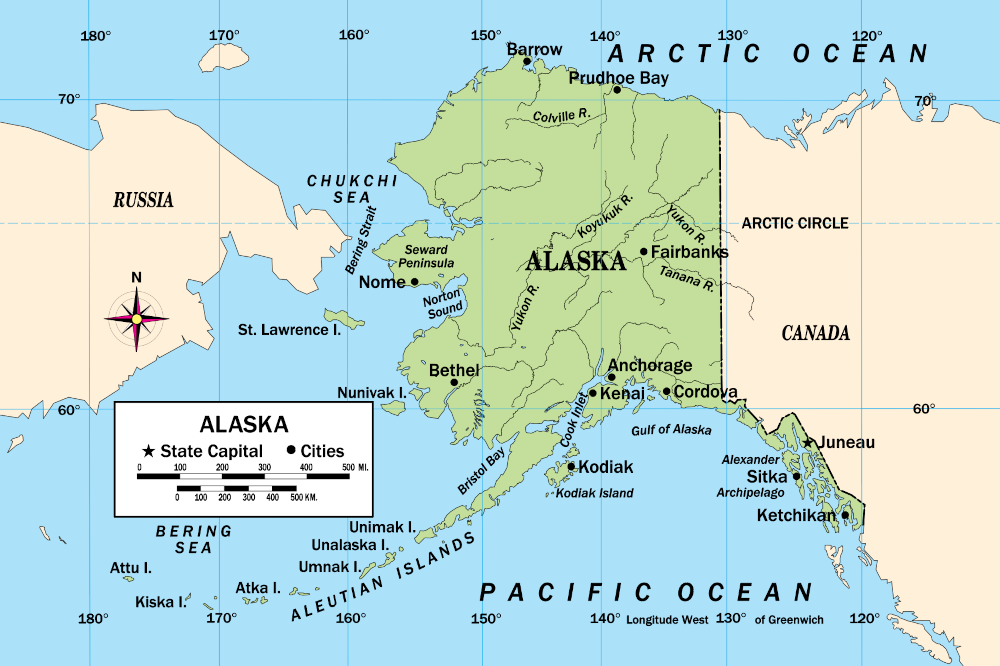
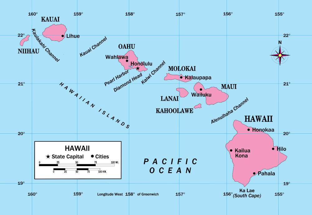
There are all kinds of maps—weather maps, maps that show the bottom of the ocean, even maps that track satellites. Most of the maps in your handbook are political maps. Political maps show how the earth is divided into countries and states. They also show the capitals and major cities.
WT 401
Page 401
Reading Maps
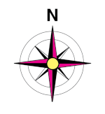
Map Symbols
Mapmakers use special marks and symbols to show direction (north, east, south, and west). To the right is a direction finder. It will show you where north is. If a map does not have a direction finder, north is probably at the top of the page.

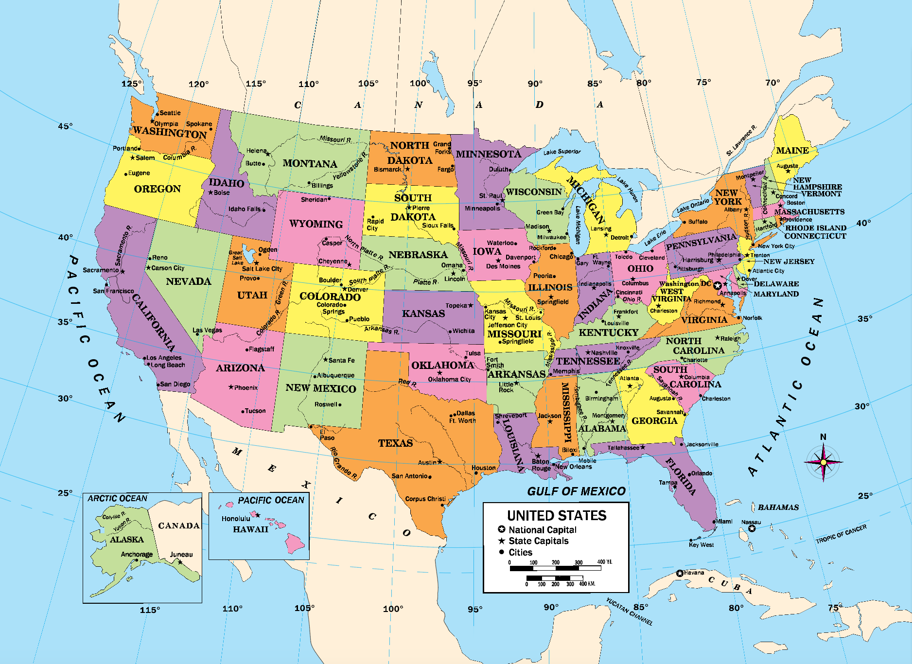
The Legend
Important symbols are explained in a box printed on each map. This legend, or key, helps you understand and use the map. This map legend from the United States map includes symbols for state capitals, cities, and more.
The Map Scale

Legends also have a map scale. The map scale shows you how far it is between places. Here is the scale from the map of the United States. It uses inches.
WT 402
Page 402
Latitude and Longitude
Latitude ●
The lines on a map that go from east to west around the earth are called lines of latitude. Latitude is measured in degrees, with the equator being 0 degrees (0°). Lines above the equator are called north latitude. Lines below the equator are called south latitude.
Longitude ●
The lines on a map that run from the North Pole to the South Pole are lines of longitude. The north-south line measuring 0° passes through Greenwich, England. This line is called the prime meridian. Lines east of the prime meridian are called east longitude. Lines west of the prime meridian are called west longitude.

Coordinates ●
The latitude and longitude numbers of a country or other place are called its coordinates. In each set of coordinates, latitude is written first, then longitude. In the map above, the African country Liberia is located at 7° N, 10° W.
WT 403
Page 403
WT 404
Page 404
WT 405
Page 405

WT 406
Page 406
WT 407
Page 407
WT 408
Page 408
WT 409
Page 409
WT 410
Page 410
WT 411
Page 411

WT 412
Page 412
WT 413
Page 413
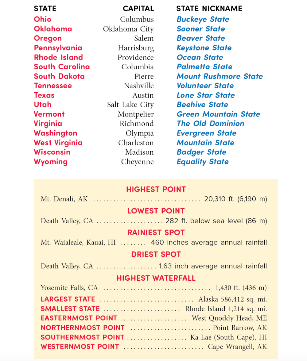
Facts About the 50 States

WT 414
Page 414
State Capitals and Nicknames

WT 415
Page 415
WT 416
Page 416
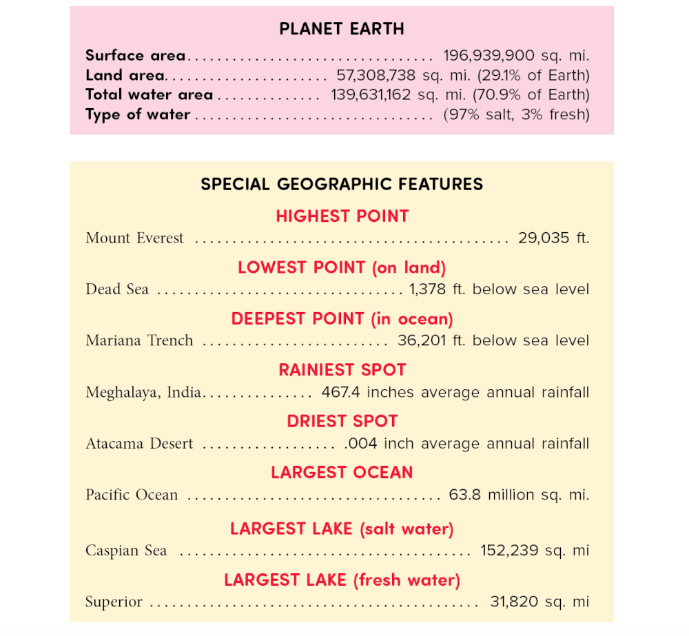
Facts About World Geography
Our world is a magnificent place. There are oceans and mountains and reefs. These natural wonders come in all shapes, sizes, and temperatures.
WT 417
Page 417

WT 418
Page 418
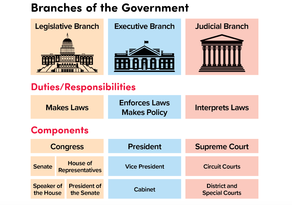
Government
Every country in the world has a government. The purpose of the government is to make and enforce laws and to protect the rights of its citizens. Most major countries in the world also have a constitution, a basic set of laws by which the people are governed.
The U.S. Constitution establishes the form of the United States government and explains the rights and responsibilities of its citizens. This section of your handbook takes a closer look at those rights and responsibilities, and how the government is organized.
WT 419
Page 419
U.S. Presidents

WT 420
Page 420
Holidays and Special Days
